We develop large-scale restoration projects and the technology to back them.
Sylva structures high-integrity carbon and biodiversity credit projects — and provides the planetary intelligence that conservation, land, and investment decisions depend on.
Two practices, one mission: accelerate the restoration of our natural habitat.
We combine hands-on project development with satellite science and geospatial analytics to make environmental stewardship measurable, fundable, and scalable.
🌱
Project Development
We build and scale nature-based credit projects.
We combine hands-on project development with satellite science and geospatial analytics to make environmental stewardship measurable, fundable, and scalable.
ARR (Afforestation, Reforestation & Revegetation)
REDD+ forest conservation
Soil carbon and grassland restoration
Feasibility assessments, Project and Restoration Design, Budgeting and Carbon Modeling
Better data for conservation, land, and investment decisions.
We integrate Earth Observation, AI-driven land classification, and field data into actionable intelligence — helping organizations assess environmental risk, verify sustainability claims, and optimize land use.
Biomass mapping, canopy analysis, and carbon stock estimation via satellite
Deforestation risk modeling and land-use change detection
Biodiversity hotspot identification and habitat corridor planning
Supply chain and commodity procurement intelligence
Landscape restoration planning with climate projections
Augment — our field tool merging smartphone data with satellite imagery
Whether you’re developing credits or commissioning intelligence, we follow a transparent process grounded in science.
01
Assess
We analyse your land using satellite imagery, species databases, climate and carbon models to map biomass, sequestration potential, ecosystem integrity, pressure points, biodiversity value, and deforestation risk.
02
Design
We recommend the right credit pathway, conservation intervention, risk mitigation or intelligence product — with methodology matching, revenue projections, community involvement and a clear development roadmap.
03
Develop
Project Design Documents, feasibility studies, stakeholder engagement, FPIC and financing strategy — we handle the complexity.
04
Monitor
Our digital MRV framework automates satellite-based monitoring, ground-truthing, and compliance reporting to keep projects verified and credits flowing.
Planetary Intelligence
We combine hands-on project development with satellite science and geospatial analytics to make environmental stewardship measurable, fundable, and scalable.
Multi-spectral imagery from Planet Labs, Sentinel-2, EnMAP, and NISAR for canopy, biomass, and soil analysis
AI models trained on tropical and subtropical ecosystems for deforestation prediction and species mapping
Augment — zero-config field tool merging smartphone captures with satellite data for parcel-level insights
Automated MRV pipelines compliant with VCS, Gold Standard, and emerging biodiversity frameworks
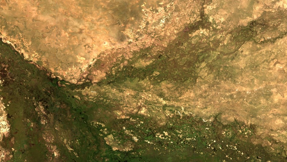
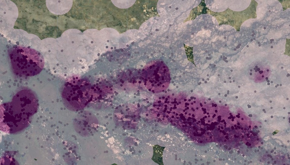
Earth Observation Analysis of the Okavango Delta
Planetary Intelligence
We combine hands-on project development with satellite science and geospatial analytics to make environmental stewardship measurable, fundable, and scalable.
Multi-spectral imagery from Planet Labs, Sentinel-2, EnMAP, and NISAR for canopy, biomass, and soil analysis
AI models trained on tropical and subtropical ecosystems for deforestation prediction and species mapping
Augment — zero-config field tool merging smartphone captures with satellite data for parcel-level insights
Automated MRV pipelines compliant with VCS, Gold Standard, and emerging biodiversity frameworks